

30K+
Pieces of equipment
monitored

2M+
Trees
managed

5000+
Satisfied
users
What is GreenSpaces?
GreenSpaces is an integrated and geo-referenced platform to organise and document the care and maintenance of urban greenery in the most efficient way.
Its simple and user-friendly interface, tailored to the needs of clients, makes GreenSpaces the ideal software solution for all those involved in green management.
Thanks to web and mobile technology, all users can access a constantly updated database from any location.
Advantages

Increased efficiency
Green management based on solid, up-to-date information is more cost-efficient. Historical data is accessible to users at all times and provides comprehensive survey information of managed areas.

Public participation
Public engagement in green management, made possible with citizen reporting tools, results in higher quality standards for green areas.

Integration
Our flexible open standards based solutions can be easily integrated into other IT systems. This gives you full control of your data at all times via clearly documented interfaces.

Improved safety
Updated monitoring of trees and play equipment helps reduce the risk of accidents in public areas. GreenSpaces keeps track of tree assessments, playground inspections and maintenance activities.

Innovation
GreenSpaces integrates the latest innovation in data capture, environmental sensors, NFC and RFID tagging. R3GIS is constantly investing in research and development to keep its software solutions at the cutting edge of technology.
Used by thousands of urban green management professionals

Companies

Public Administrations

Tree & Playground Consultants
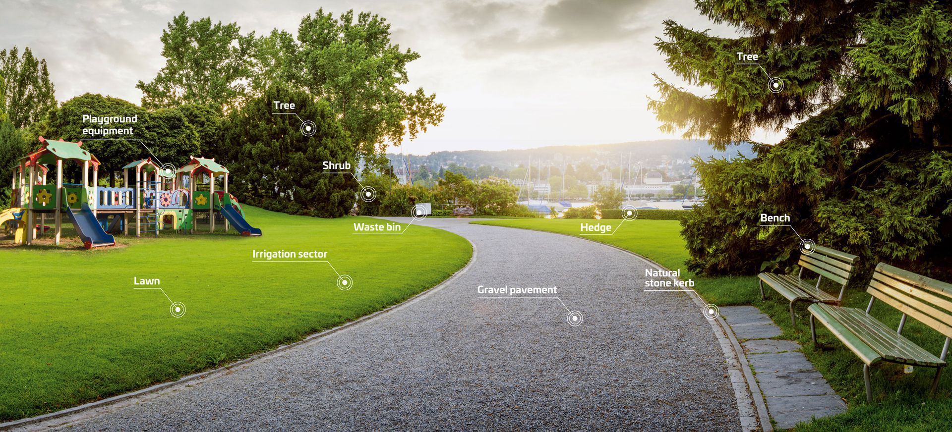
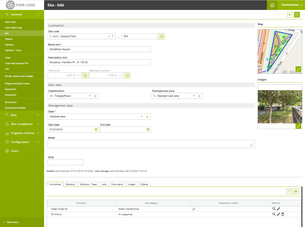
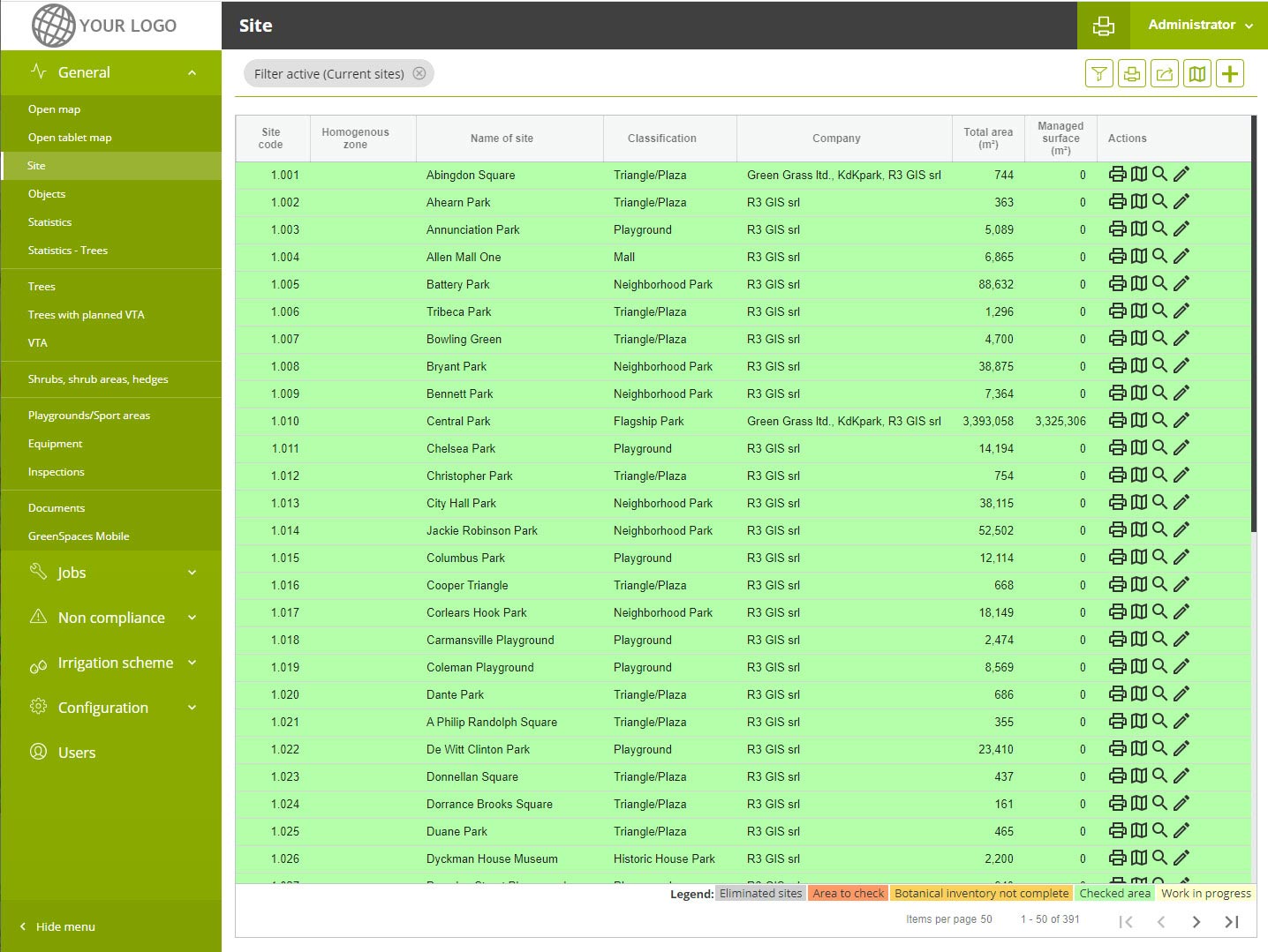
What is Managed?
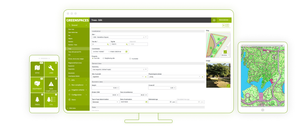
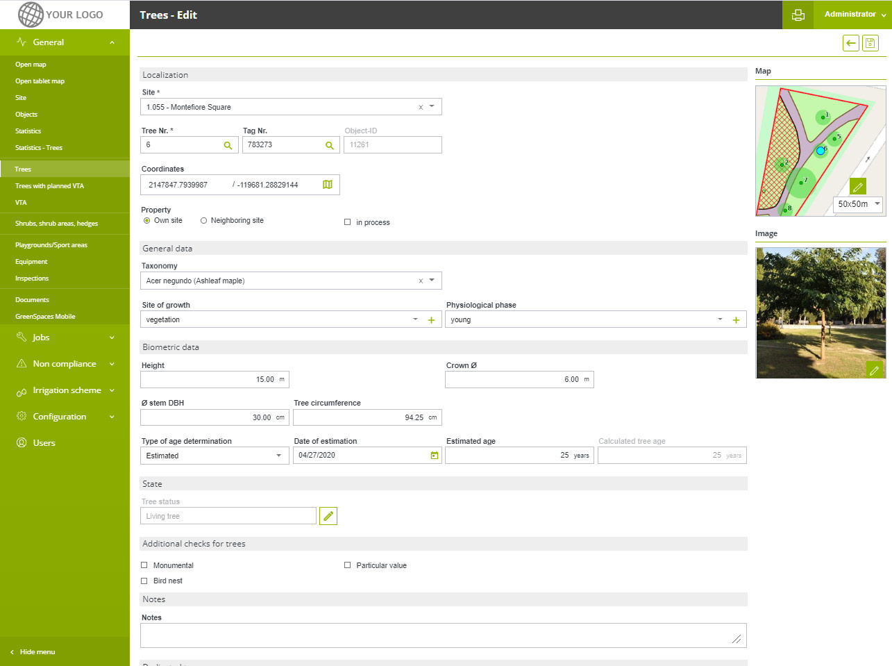
GreenSpaces manages all elements of green areas in a spatial database. The software lets users plan maintenance jobs, track issues with attached documents and photos, and carry out assessments on trees and playground equipment.
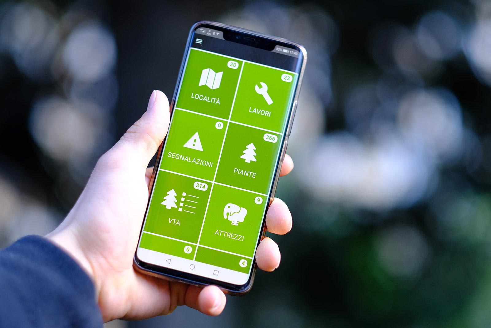
Via the GreenSpaces mobile app, users can monitor and document operations directly in the field. Numeric or RFID tags help identify objects under management and provide full traceability for all activities.
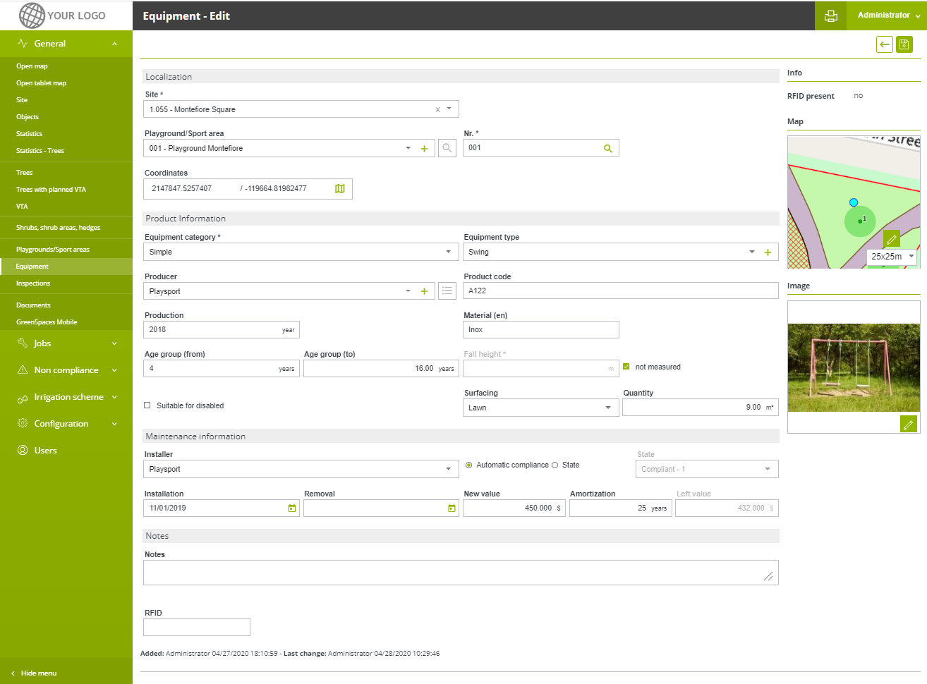
Trees and Equipment
For the management of trees, recreational and sports equipment GreenSpaces provides specific procedures, which accurately track inspections and maintenance activities carried out.
Data of managed objects, monitoring forms, validation procedures, types of jobs and user profiles are all highly configurable, providing clients with an interface solution that perfectly fits their needs.
GreenSpaces Addon Modules
GreenSpaces was designed to provide a fully comprehensive solution for inventory and management of urban green areas. During the last few years, R3GIS has worked closely with pilot cities and research institutions to further extend the functionality of our platform. We've developed a set of additional modules that help cities adapt to climate change, reduce the carbon footprint of maintenance activities and foster citizen engagement.
What they say about us
"At this moment, in my opinion, there is no better ready-made solution than GreenSpaces."
"We've found GreenSpaces a super programme. It gives us the possibility to see all sites in one view and to see which contractor is doing which task."
"Now we can share the information about green management to companies who help us care for trees as well as with other employees and citizens."
"Before GreenSpaces was introduced, the communications overhead was extremely high. 5-6 people were occupied for a whole day to bring together the organisation for executing tree care tasks. Now, it took five clicks."
"[With GreenSpaces, green management] is a lot faster and a lot more accurate."
Technical Aspects
A single, up-to-date database
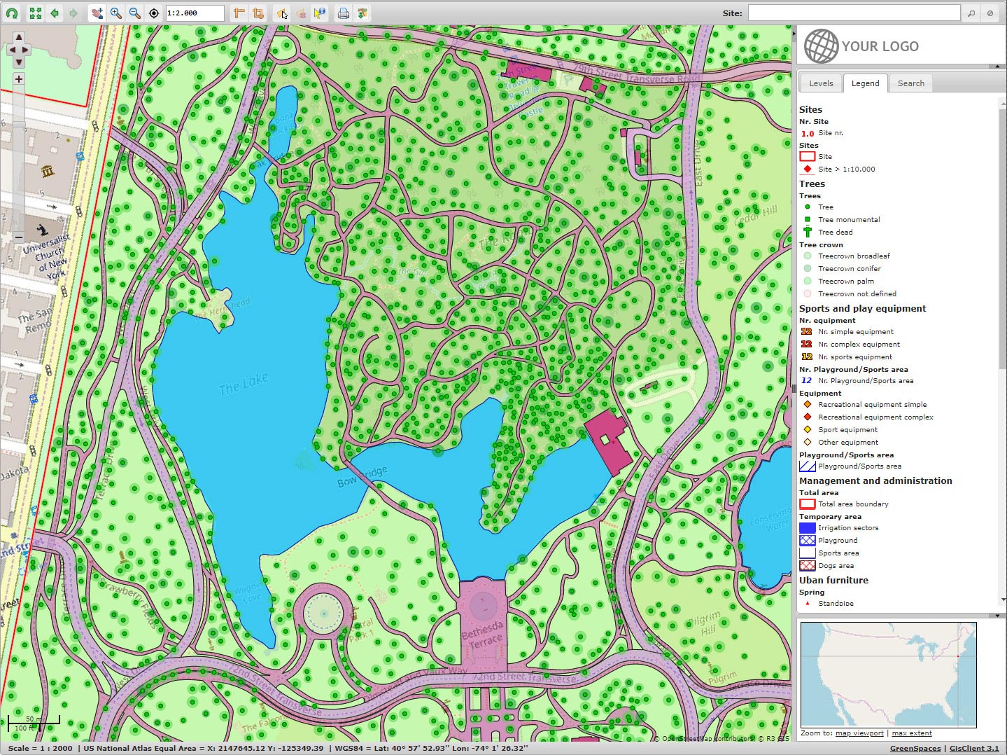
All information about sites and their elements can be browsed in real time by all stakeholders involved in green management.
Sharing
The activity calendar for each site is shared with contractors and administrators as a detailed job list or Gantt chart. Users can view only those activities for which they have responsibility.
Software as a Service
GreenSpaces is available as Software as a Service (SaaS) with an annual subscription fee, which includes the use of the web platform and the mobile app, hosting service, the daily data back-up and remote support.
Unlimited number of users
You decide who uses the platform. There is no limit on the number of users you can create for all stakeholders involved in the management of green areas.
Scheduling
Maintenance activities, tree assessments and inspections can be scheduled and assigned to operators. Automatic procedures allow planning of activities dependant on inspection outcomes.
Offline operation
Information is updated directly on the field through the mobile app, even without internet connectivity.
Data import/export
GreenSpaces allows authorised users to import and export survey data in a standardised and documented format.
Plans
GreenSpaces is available in various plans for companies, public administrations and tree and playground experts.
Plans
Below are listed the different GreenSpaces features
| FUNCTIONS | GREENSPACES | TREES | PLAY |
|---|---|---|---|
| Unlimited number of users with differentiated roles | |||
| Site form with features, documents, statistics | |||
| Customizable basemap | |||
| Job management with relative costs, timing and planning | |||
| Prints in PDF format, exports in XLS and SHP formats | |||
| Official iOS and Play Store app for smartphone or tablet for field work | |||
| Tree form with visual and instrumental stability assessments | |||
| Positioning of roadside trees with linear referencing | |||
| Play- and Sports equipment form with inspections | |||
| Management of all types of objects (greenery and urban furniture) | |||
| Monitoring of issues and non-compliances | |||
| Import survey from SHP format |
An additional Enterprise plan includes all features of GREENSPACES for multiple clients, each with a custom configuration.
Our Partners
Explore our trusted partner network and discover how our collaborations can help drive success. If you'd like to learn more about our products, get in touch with a partner near you.
FIND OUT MORE
Gallery
GreenSpaces gallery